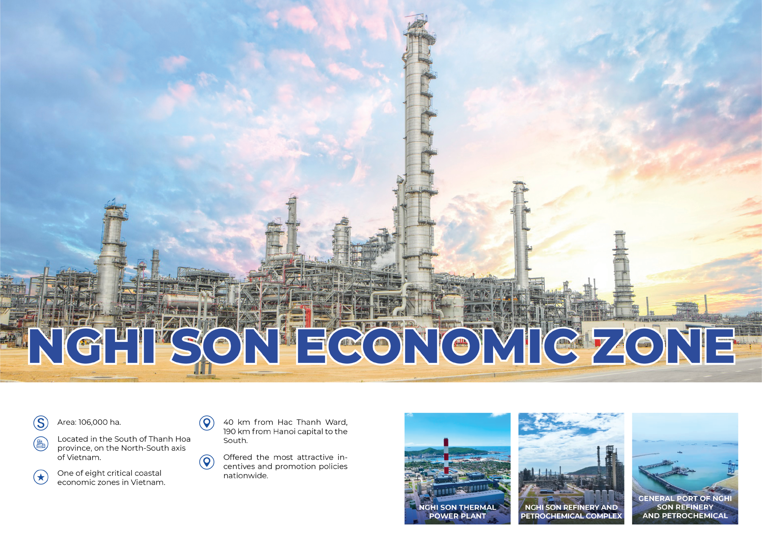
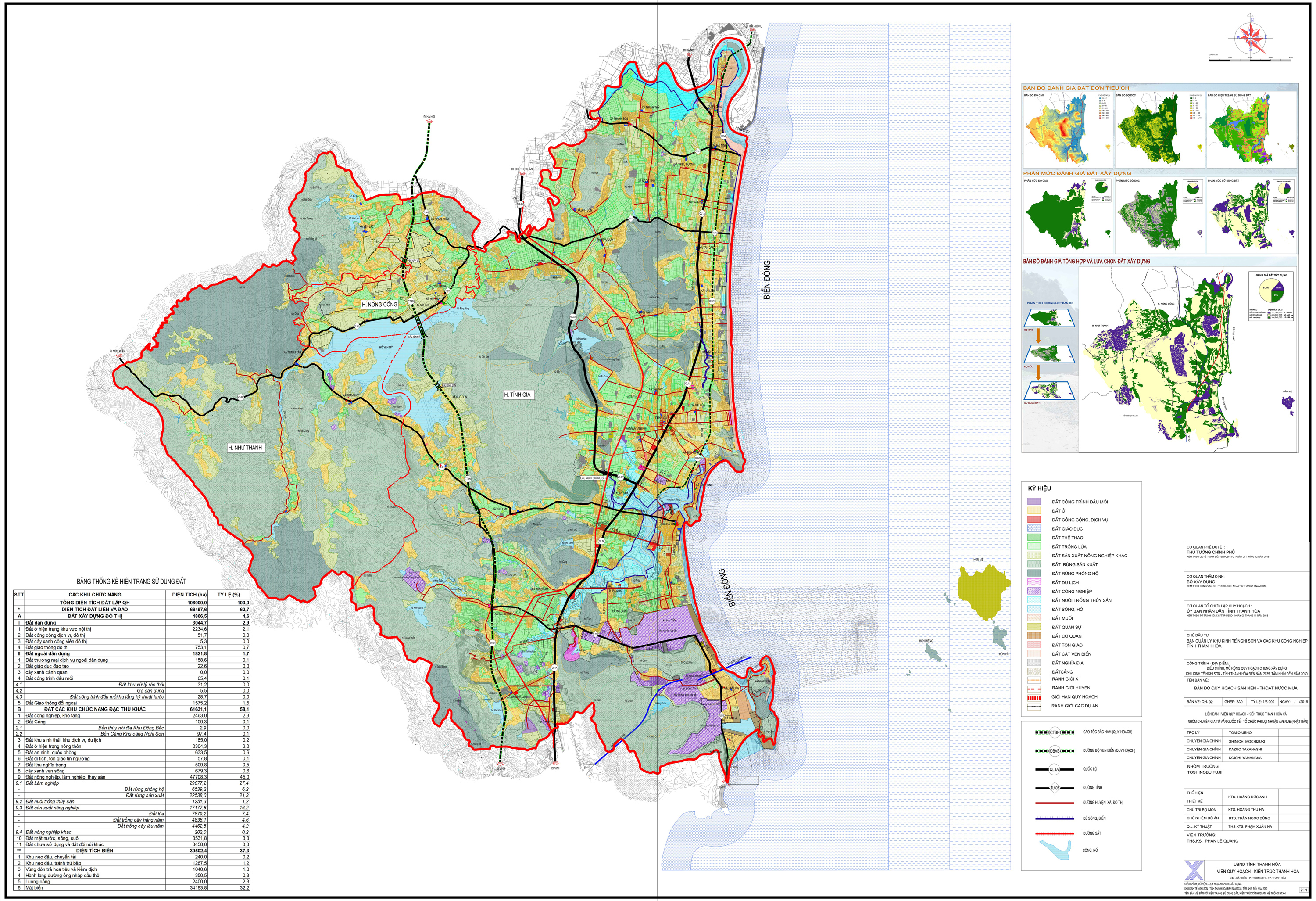
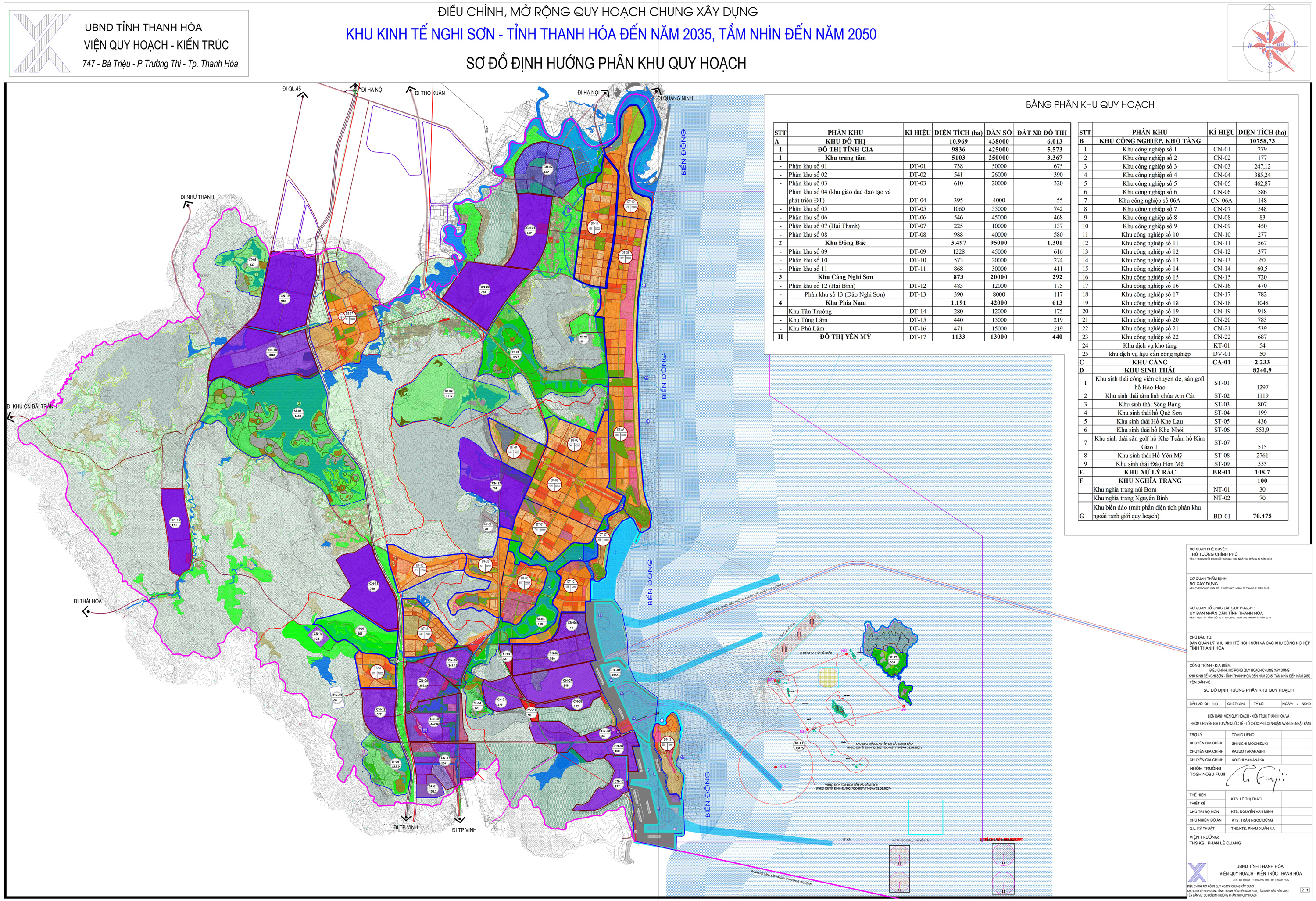
PLANNING OF FUNCTIONAL AREAS IN THE NGHI SON ECONOMIC ZONE
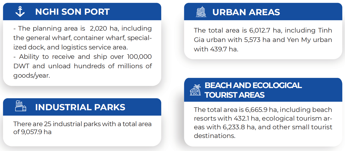
Nghi Son economic zone was established in 2006 by the Prime Minister and adjusted and expanded the general plan in 2018, with a total area of 106,000 ha, located in the south of Thanh Hoa province, on the north-south traffic axis, 190km from Hanoi capital. It is a bridge connecting the Northern region with the Central region, the Northwest and the South with the markets of Southern Laos and Northeast Thailand. Nghi Son economic zone is a multi-sector, multi-field general economic zone, selected by the Government of Vietnam as one of the eight key coastal economic zones, with the most attractive investment incentives in the country; divided into 55 subdivisions, of which, there are 25 industrial zones, with an area of about 9,057.9 ha.
1.1 Transportation system
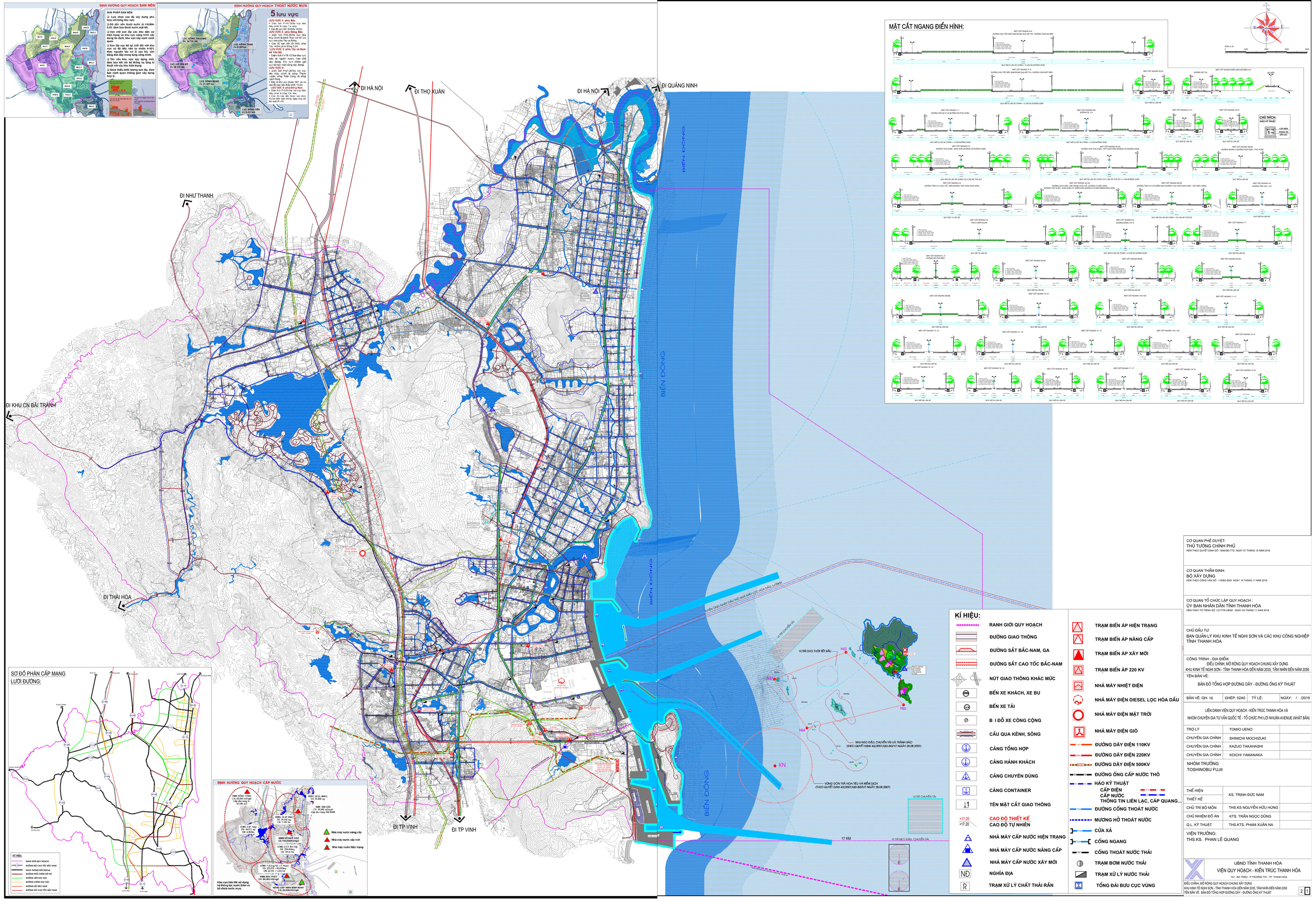
- Road systems include National Highway 1A and the North-South National Expressway passing through, coastal road connecting the North Central and North Central economic regions, Nghi Son - Bai Tranh road connecting to Ho Chi Minh road, Nghi Son road to Tho Xuan Airport. Internal traffic system is seamlessly connected among Nghi Son port, industrial zones and urban areas.
- Railway systems include national railway running through Nghi Son Economic Zone with a length of over 30km, railway connecting cargo stations at Nghi Son port with transit stations and passenger stations to meet transportation needs for Nghi Son Economic Zone.
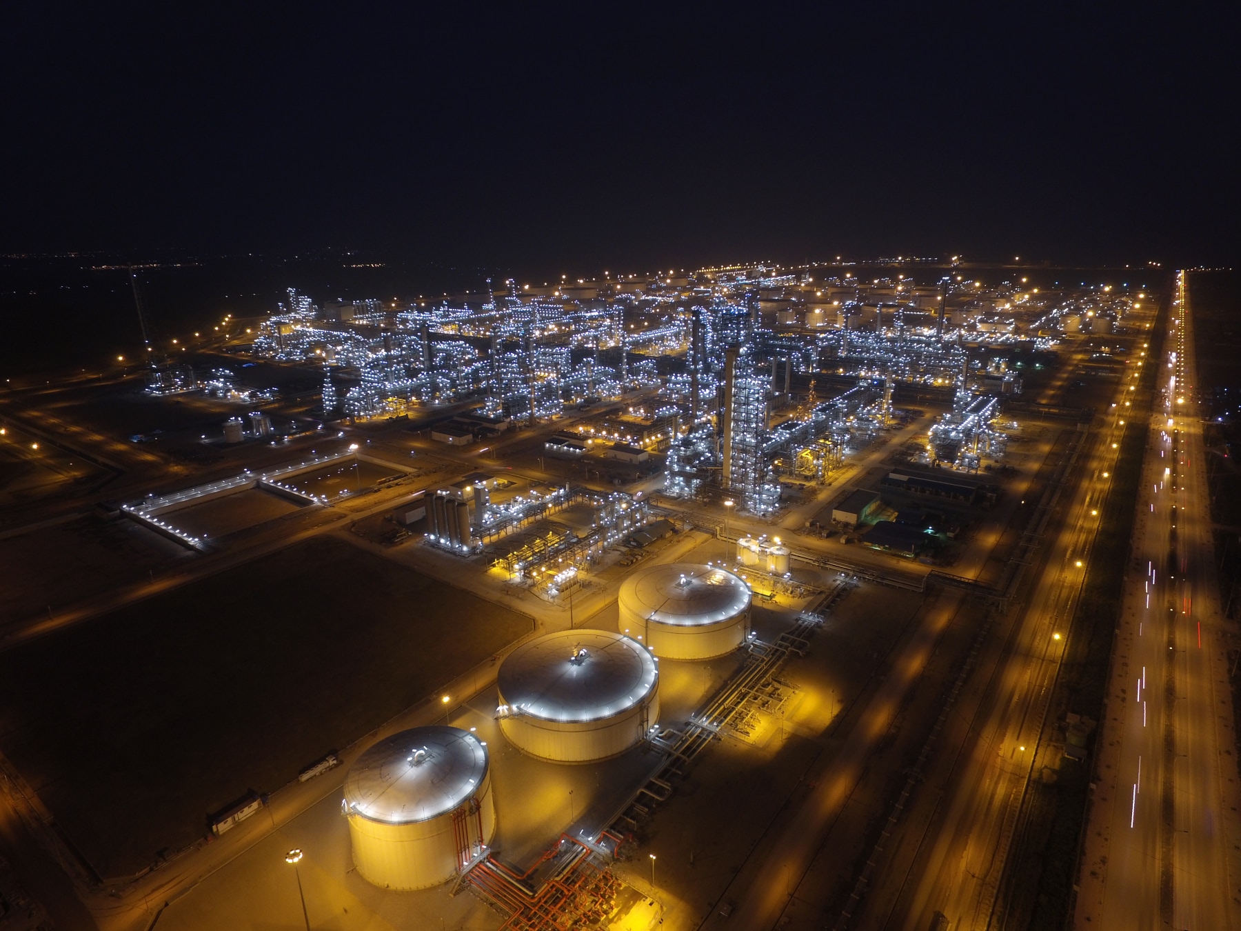
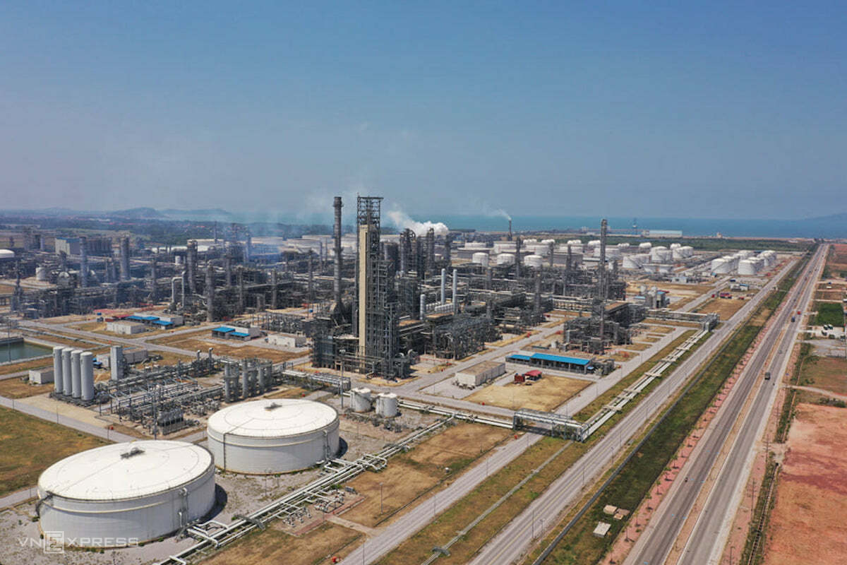
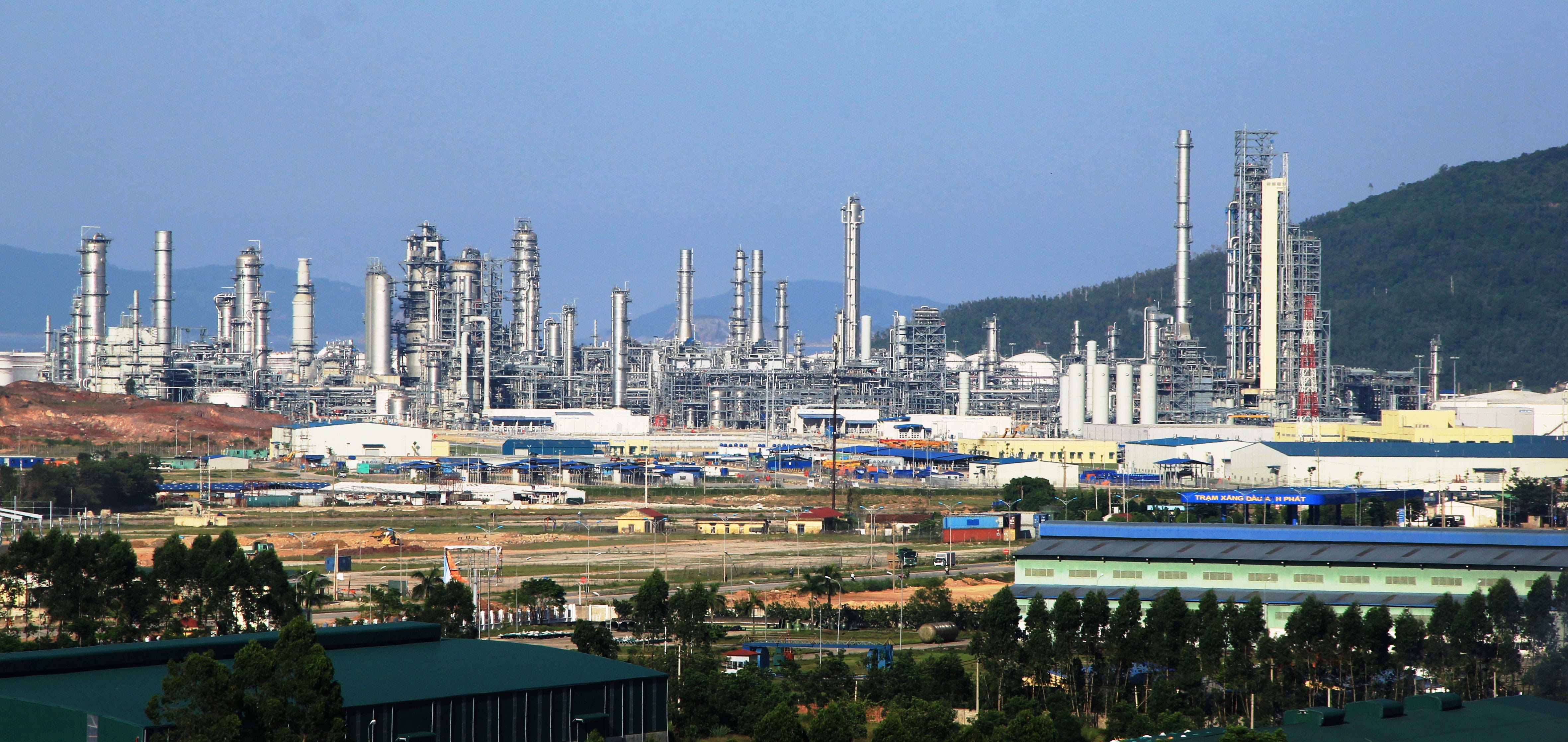
- Nghi Son deep-water seaport which is identified as a national general port, a regional hub (type I) and is planned as a special seaport with an area of the planning is 2,020 ha, including general wharfs, container wharfs, specialized wharfs and logistics service areas; capable of exploiting hundreds of millions of tons of cargo/year and receiving ships with a tonnage of up to 100,000 DWT, with a handling capacity of millions of tons/year. Currently, CMA-CGM has opened international container transport routes from Nghi Son to Singapore; from Nghi Son to Europe, the West Coast of the United States, and Africa through the transit port of Singapore.
- Aviation: Tho Xuan airport is 60km from Nghi Son economic zone. Currently, it has been exploiting domestic routes, which is planned to become an international airport.
1.2. Power System:
Using the national electricity network including North-South 500kv line and Thanh Hoa-Nghe An 220kv line and a system of 220/110/22Kv - 250MVA substations to ensure sufficient power for production and daily life.
1.3. Water Supply System:
Raw water is taken from Yen My lake (87 million m3) and Song Muc lake (200 million m3) by raw water pipeline system.
Clean water: currently has 02 factories with a capacity of 150,000m3 /day and night.
1.4. Telecommunication Services:
Telecommunication services are advanced with high speed and capable of meeting the needs of telecommunications and information technology services with the highest quality for customers.
1.5. Social Infrastructure
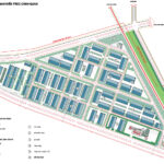
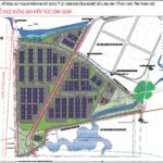
The system of schools, hospitals, commercial services, hotels have been synchronously planned. Some projects are in operation and under construction such as North Nui Xuoc public service complex, Hop Luc International General Hospital in Nghi Son area, Campus 2 Vietkids kindergartens, public housing area individuals, commercial banks, insurance services, which basically meets the needs of experts and people in Nghi Son Economic Zone.
II. DRAWING FILE
2.1. Map of development orientation planning for Nghi Son economic zone.

2.2. Existing Conditions Drawing
2.3. Land Use Planning Map
2.4. Transportation Planning Map

2.5. Schematic Map of Power Lines and Pipelines